



Category: Military Architecture > Castle
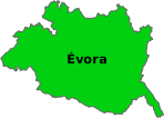
District: Évora > Estremoz > Évora Monte > Bairro Mourique
- Located in the parish of Évora Monte, municipality of Estremoz, district of Évora, Alentejo, Portugal.
- Situated on the top of the Serra de Ossa, offering a panoramic view to the Castle of Estremoz.
- Declared a National Monument on June 23, 1910.
- Prehistory: It has evidence of human occupation since prehistory.
- Christian Reconquest: Conquered from the Moors in 1160 by Geraldo sem Pavor (Gerald the Fearless).
- 13th Century: Fortifications restored by D. Afonso III: first charter granted in 1248, renewed in 1271.
- 14th Century: D. Dinis ordered the fortification of the village in 1306.
- Dynasty of Avis: Passed to D. Nuno Álvares Pereira and then to the House of Braganza.
- 16th Century: D. Manuel granted a new charter in 1516: reconstruction in the Italian Renaissance style after the 1531 earthquake.
- Style: Combines Gothic and Renaissance elements of Italian inspiration.
- Structure: Quadrangular plan with four truncated conical towers at the corners.
- Interior: Three vaulted floors with ashlar pillars: Manueline ornaments on the columns of the ground floor.
- Terrace: Wide battlements used as an artillery firing platform.
- Convention of Évora Monte: Signed on May 26, 1834, ending the Liberal Wars.
- Extinction of the Municipality: The municipality was extinguished on October 24, 1855, being divided between neighboring municipalities.
- First interventions in the 1930s and continued in the 1940s.
- New restoration campaigns between 1971 and 1987.
- Since 2021, the castle has been under the responsibility of the Estremoz City Council.
- The turrets have a wider base than the top, a typical characteristic of the Manueline style.
- The sections of the walls are adorned with knots carved in stone.
Sources: https://pt.wikipedia.org/wiki/Castelo_de_Évora_Monte
Coordinates DD: 38.77188620748369,-7.715802370854132
Coordinates DMS: 38°46'18.8"N 07°42'56.9"W
 Weather Évora Monte


 On-duty Pharmacy Évora Monte