




Category: Culture and Entertainment > River Aquarium
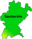
District: Santarém > Vila Nova da Barquinha > Praia do Ribatejo
Located in Praia do Ribatejo, in the municipality of Vila Nova da Barquinha, the space is situated next to the mouth of the Zêzere River, where it meets the Tagus River. The surroundings are marked by riverbanks, riparian vegetation, and rocky outcrops that help in understanding the environment depicted inside.
From the outside, the town of Constância and the Zêzere Valley can be seen. There are outdoor rest areas with views of the confluence of the rivers, a scenario that reinforces the project's connection to the territory.
The fluviarium showcases the fauna and habitats of the Zêzere River mouth region, including native species as well as some exotic ones that now occupy these watercourses. The objective is to demonstrate how they live, how they feed, and how the ecosystem reacts to the changes caused by human presence.
The visit is interpretive and educational. The information combines accessible language with scientific data, allowing for the recognition of behaviors, adaptations, and life cycles of freshwater fish and invertebrates.
The aquariums recreate stretches of river with sand and gravel beds, logs, macrophytes, and rocks. Large cyprinids, such as carp with their thick scales and barbels near their mouths, shoals of small fish from calm waters, and species that seek the bottom, can be observed. In specific tanks, invertebrates like freshwater crayfish live, useful for understanding the feeding dynamics of rivers.
Panels and digital displays explain the difference between native and invasive species, their impacts, and conservation measures. Models help visualize the anatomy of fish and how they breathe, move, and reproduce.
A documentary film accompanies the journey of the Zêzere River from its springs to its meeting with the Tagus, highlighting landscapes, history, and water uses in the region. The narrative is designed for various age levels and emphasizes the relationship between rivers and communities.
There are also activities that revisit traditional practices associated with rivers. The gold prospecting simulation simply explains how alluvial washing was done and what marks it left on the territory. A scale model shows the functioning of a hydroelectric dam, from the filling of the reservoir to the activation of a turbine, facilitating the understanding of energy production.
The circuit invites close observation of details. In the larger tanks, carp exhibit slow swims and robust lateral movements, while small fish seek refuge among aquatic plants. The contrast of light sands with rock shadows reproduces the broken lights typical of a river.
At the end, the outdoor area allows for a pause with a view of the Zêzere River mouth, a setting that completes the experience by connecting what was seen inside with the real scenario of the fluvial system that gives it its name.
Sources: https://www.fozdozezere.pt/
Coordinates DD: 39.47598337753017,-8.343474804555544
Coordinates DMS: 39°28'33.5"N 08°20'36.5"W
 Weather Praia do Ribatejo



 On-duty Pharmacy Praia do Ribatejo