






Category: Military Architecture > Walls
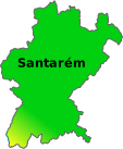
District: Santarém > Santarém > Alcanede
Erected atop a hill in the village of Alcanede, municipality of Santarém, the castle dominates the surrounding rural landscape. Its elevated position allows one to read the rolling relief of the Ribatejo, with patches of pine forest and olive groves cutting across the valley.
From the wall, one can see the village houses to the south and, on clear days, a wide, almost circular horizon. The natural setting reinforces the fortification's defensive character and offers a photogenic backdrop along its entire perimeter.
The site was occupied since Antiquity, first as a hillfort and later fortified by the Romans. In the Middle Ages, it passed through Visigothic and Muslim hands until it was integrated into the Kingdom of Portugal during the campaigns of D. Afonso Henriques in the 12th century.
Between the 13th and 14th centuries, the fortress underwent reinforcement works and was associated with the Order of Avis. The earthquake of 1531 marked the beginning of its decline, and only in the 20th century, starting in the 1940s, did the Directorate-General for Buildings and National Monuments consolidate the structures visible today. Since 1943, the castle has been classified as a Property of Public Interest.
The complex features simple and robust design, with a walled enclosure of a predominantly oval plan. Highlights include the keep crowned with battlements, an advanced barbican tower, sections of barbican, and wall-walks surrounding a central courtyard. Entry is gained through a semi-circular arch topped by a heraldic cartouche. Inside, a vaulted cistern remains, a testament to the autonomy required during a siege.
The route includes narrow stairs and passages, especially accessing the tower, which requires extra caution. The granite and limestone of the construction take on vivid hues in the late afternoon, creating an interesting contrast with the green of the hillside and the open sky seen in the photograph, where the cut-out battlements and the flag atop the keep stand out.
Coordinates DD: 39.417138394444,-8.8214512333333
Coordinates DMS: 39°25'1.7"N 08°49'17.2"W
 Weather Alcanede




 On-duty Pharmacy Alcanede