



Category: Civil Architecture > Gate
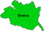
District: Évora > Évora > Évora
The Porta Nova da Traição (New Gate of Treason) is situated in Évora, in the area connecting the Pátio de São Miguel to the Largo dos Colegiais. It is integrated into the city's former defensive system, in an area where the medieval walls still shape the urban layout.
The location maintains a tranquil atmosphere, marked by thick stone walls and changes in terrain elevation that reveal the age of the structures. The surroundings combine narrow streets, gentle slopes, and historical structures that help to understand how the city organized itself around the ancient defenses.
The Porta Nova da Traição acquired its name from the events of January 1384, a decisive moment in the political crisis preceding the rise of the Master of Avis. According to accounts, the garrison stationed in the old castle refused to yield to the popular movement supporting the new leadership in the kingdom.
Amidst the conflicts that shook Évora at the time, the gate served as an escape route for the defenders loyal to D. Leonor Teles. The passage thus became associated with a hasty retreat, marked by the tension and instability of that period.
The gate appears as a simple opening in the curtain wall, topped with austerely worked stone. The structure highlights the functional nature of urban defenses, where the priority was security and control of access, rather than ornamentation.
Observing the site, one notices the irregularity of the ground, with rocky outcrops near the base of the wall. These elements contribute to an environment that mixes ruin, antiquity, and serenity, offering a clear insight into how the city defended itself and grew over the centuries.
The space conveys a sense of quietude, reinforced by the light falling on the ancient stones and the shadows cast throughout the day. It is a point where one feels the passage of time and where the historical dimension manifests very directly.
Those passing by can closely observe the original materials, understand the adaptation of the defenses to the relief, and imagine the intensity of the events that marked this location at the end of the 14th century.
Coordinates DD: 38.57280431597145,-7.905325551097953
Coordinates DMS: 38°34'22.1"N 07°54'19.2"W
 Weather Évora



 On-duty Pharmacy Évora