






Category: Military Architecture > Fort
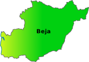
District: Beja > Beja > Quintos
The Fort of Vau de Baixo is located on the banks of the Guadiana River, near the village of Quintos, in the municipality of Beja. The structure stands at a point where the river describes a wide curve, on slightly elevated ground surrounded by Mediterranean vegetation. From this location, one can view the riverside landscape of the Guadiana, marked by the contrast between the calm waters and the arid hills of Alentejo.
Access is via rural roads that wind between agricultural fields and old watermills, allowing for a tranquil approach to the river. The environment is silent and dominated by the sounds of nature, making the location especially evocative for observing the natural surroundings and the course of the Guadiana.
The Fort of Vau de Baixo was ordered to be built during the reign of D. João IV, following the Restoration of Independence, in the first half of the 17th century. Its function was to watch over and control the crossing of the Guadiana, which was done here by ford or ferry, at a strategic crossing point between banks. This small fort was part of a defensive system composed of several similar structures along the right bank of the river, between the municipalities of Beja, Vidigueira, and Mértola.
The small, isolated, and small-sized forts aimed to deter Castilian incursions and protect the watermills that supplied the local populations. Its construction reflects the need for defense with limited resources, relying on local labor and materials available in the region, such as schist, diorite, and lime.
With a singular appearance, the Fort of Vau de Baixo has a ship's bow shape, facing upstream, as if confronting the waters of the Guadiana. This configuration was not merely symbolic: it served to resist the force of floods, common in the area. The redoubt is completely enclosed, without doors or windows, which reinforces its massive and impregnable appearance. Access to the interior was via a movable ladder, which increased the security of the garrison.
With about 20 meters in length, 5.5 meters in width, and 8 meters in height, its considerably thick walls incorporate twenty-one small openings (embrasure), intended for the use of firearms. A moat surrounded the structure, hindering approach. Inside, there would have been a brick vault, now partially collapsed, and a patrol path protected by a parapet. Despite the visible degradation, the constructive ingenuity and robustness of the building remain recognizable.
The fort is situated in a riverside landscape of great ecological value, integrated into the Guadiana Site of the Natura 2000 Network. On the banks grow oleanders, poplars, and willows, among stretches of Mediterranean scrub with rockroses and holm oaks. The fauna is varied, with the presence of otters, wild boars, eagles, and numerous species of aquatic birds.
The serenity of the place, combined with the discreet impressiveness of the ruins, creates a setting with a strong historical charge. Between the sound of the wind and the water, the visitor has the sensation of traveling back in time, imagining the soldiers who, more than three centuries ago, watched over the river and the kingdom's borders there.
Coordinates DD: 37.92634818971108,-7.669202423300732
Coordinates DMS: 37°55'34.9"N 07°40'9.1"W
 Weather Quintos



 On-duty Pharmacy Quintos